France Geocode Database v.2.0.0
106,679 Database Records


 AccountWelcome, guestSign in / Register
Explore 106,545 distinct geographic names across 106,679 source rows for France. Includes feature identifiers, coordinates, designations and current source codes.
Ready for your workflow

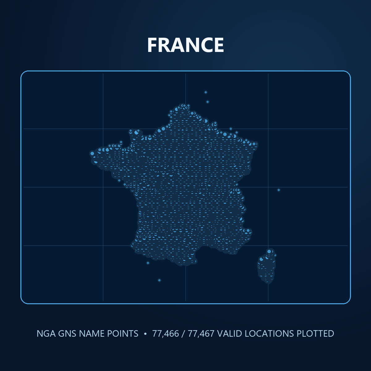
Explore 106,545 distinct geographic names across 106,679 source rows for France. Includes feature identifiers, coordinates, designations and current source codes.
The package includes 33 current NGA fields in CSV, JSON and SQLite, plus schemas, samples and field statistics. Names and coordinates should be verified for operational use.


Release structure
Review the published tables, record coverage, and field names included with release 2.0.0.
Data dictionary
| Table | Records | Fields |
|---|---|---|
| geographic_names | 106679 | rk, ufi, uni, full_name, nt, lat_dd, long_dd, efctv_dt, term_dt_f, term_dt_n, desig_cd, fc, cc_ft, adm1, ft_link, name_rank, lang_cd, transl_cd, script_cd, name_link, cc_nm, generic, full_nm_nd, sort_gen, sort_name, lat_dms, long_dms, mgrs, mod_dt_ft, mod_dt_nm, dialect_cd, display, gis_notes |
Release at a glance
106,545 distinct names in 106,679 source rows.
Select a table to review its schema, record total and fields. Distinct counts exclude nulls. Missing counts include null and blank values where measured.
Inspect the data
Switch tables to review representative fields and rows from every table advertised for this release.
| rk | ufi | uni | full_name | nt | lat_dd | long_dd | efctv_dt | term_dt_f | term_dt_n | desig_cd | fc | cc_ft | adm1 | ft_link | name_rank | lang_cd | transl_cd | script_cd | name_link | cc_nm | generic | full_nm_nd | sort_gen | sort_name | lat_dms | long_dms | mgrs | mod_dt_ft | mod_dt_nm | dialect_cd | display | gis_notes |
|---|---|---|---|---|---|---|---|---|---|---|---|---|---|---|---|---|---|---|---|---|---|---|---|---|---|---|---|---|---|---|---|---|
| 1 | -1459401 | -2089146 | Pic du Port | N | 42.64991 | 1.533353 | PK | T | AND,FRA | S1-000 | 1 | FRA | Pic | Pic du Port | PIC | PICDUPORT | 42:39:00 | 1:32:00 | 31TCH7977822982 | 2014-10-15T00:00:00.000Z | 2014-09-17T00:00:00.000Z | 1,2,3,4,5 | ||||||||||
| 1 | -1461027 | -4834010 | Port de Ransol | N | 42.633333 | 1.65 | PASS | T | AND,FRA | S1-000 | 1 | AND,FRA | Port | Port de Ransol | PORT | PORTDERANSOL | 42:38:00 | 1:39:00 | 31TCH8931120982 | 2014-09-17T00:00:00.000Z | 2014-09-17T00:00:00.000Z | 1,2,3,4,5 | ||||||||||
| 1 | -1459401 | -2089147 | Pic de Font Blanca | N | 42.64991 | 1.533353 | PK | T | AND,FRA | S1-000 | 2 | AND | Pic | Pic de Font Blanca | PIC | PICDEFONTBLANCA | 42:39:00 | 1:32:00 | 31TCH7977822982 | 2014-10-15T00:00:00.000Z | 2014-09-17T00:00:00.000Z | 1,2,3,4,5 | ||||||||||
| 1 | -1450717 | -2077841 | Roc Meler | V | 42.587649 | 1.740278 | MT | T | AND,FRA | S1-000 | Roc Meler | ROCMELER | 42:35:16 | 1:44:25 | 31TCH9663715795 | 2014-10-07T00:00:00.000Z | 1993-09-01T00:00:00.000Z | 1,2,3,4,5 | ||||||||||||||
| 1 | -1451583 | -2003925 | Pic de Mil-Menut | N | 42.633333 | 1.65 | PK | T | AND,FRA | S1-000 | 1 | AND,FRA | Pic | Pic de Mil-Menut | PIC | PICDEMILMENUT | 42:38:00 | 1:39:00 | 31TCH8931120982 | 2014-09-17T00:00:00.000Z | 2014-09-17T00:00:00.000Z | 1,2,3,4,5 | ||||||||||
| 1 | -1450717 | -4833998 | Roc Mélé | N | 42.587649 | 1.740278 | MT | T | AND,FRA | S1-000 | 1 | AND,FRA | Roc | Roc Mele | ROC | ROCMELE | 42:35:16 | 1:44:25 | 31TCH9663715795 | 2014-10-07T00:00:00.000Z | 2014-09-17T00:00:00.000Z | 1,2,3,4,5 | ||||||||||
| 1 | -1437707 | -2060093 | Pic des Langounelles | N | 42.612033 | 1.473635 | PK | T | AND,FRA | S1-000 | 1 | AND,FRA | Pic | Pic des Langounelles | PIC | PICDESLANGOUNELLES | 42:36:43 | 1:28:25 | 31TCH7480718862 | 2014-10-15T00:00:00.000Z | 2014-09-17T00:00:00.000Z | 1,2,3,4,5 | ||||||||||
| 1 | -1427531 | -2019474 | Pic de les Abelletes | N | 42.525345 | 1.733434 | PK | T | AND,FRA | S1-000 | 2 | AND | Pic | Pic de les Abelletes | PIC | PICDELESABELLETES | 42:31:31 | 1:44:00 | 31TCH9597208885 | 2014-10-07T00:00:00.000Z | 2014-10-07T00:00:00.000Z | 1,2,3,4,5 | ||||||||||
| 1 | -1427530 | -2046477 | Étang de Font-Nègre | N | 42.529146 | 1.733624 | LK | H | AND,FRA | S1-000 | 1 | FRA | Étang | Etang de Font-Negre | ETANG | ETANGDEFONTNEGRE | 42:31:45 | 1:44:01 | 31TCH9599409306 | 2014-10-07T00:00:00.000Z | 2014-10-07T00:00:00.000Z | 1,2,3,4,5 | ||||||||||
| 1 | -1427530 | -2019473 | Estany de les Abelletes | N | 42.529146 | 1.733624 | LK | H | AND,FRA | S1-000 | 2 | AND | Estany | Estany de les Abelletes | ESTANY | ESTANYDELESABELLETES | 42:31:45 | 1:44:01 | 31TCH9599409306 | 2014-10-07T00:00:00.000Z | 2014-10-07T00:00:00.000Z | 1,2,3,4,5 | ||||||||||
| 1 | -1427531 | -2046478 | Pic de la Font-Nègre | N | 42.525345 | 1.733434 | PK | T | AND,FRA | S1-000 | 1 | FRA | Pic | Pic de la Font-Negre | PIC | PICDELAFONTNEGRE | 42:31:31 | 1:44:00 | 31TCH9597208885 | 2014-10-07T00:00:00.000Z | 2014-10-07T00:00:00.000Z | 1,2,3,4,5 | ||||||||||
| 1 | -1422145 | 15309523 | Port Vieux de Coume d’Ose | N | 42.625678 | 1.61823 | PASS | T | AND,FRA | S1-000 | 1 | FRA | Port | Port Vieux de Coume d'Ose | PORT | PORTVIEUXDECOUMEDOSE | 42:37:32 | 1:37:06 | 31TCH8669220174 | 2014-10-16T00:00:00.000Z | 2014-10-16T00:00:00.000Z | 1,2,3,4,5 | ||||||||||
| 1 | -1422145 | -2039570 | Port Vieux de la Coume d’Ose | N | 42.625678 | 1.61823 | PASS | T | AND,FRA | S1-000 | 2 | AND | Port | Port Vieux de la Coume d'Ose | PORT | PORTVIEUXDELACOUMEDOSE | 42:37:32 | 1:37:06 | 31TCH8669220174 | 2014-10-16T00:00:00.000Z | 2014-10-16T00:00:00.000Z | 1,2,3,4,5 | ||||||||||
| 1 | -1416023 | -2031677 | Porteille de la Cabanette | V | 42.6 | 1.733333 | PASS | T | AND,FRA | S1-000 | Porteille de la Cabanette | PORTEILLEDELACABANETTE | 42:36:00 | 1:44:00 | 31TCH9608817175 | 2014-09-17T00:00:00.000Z | 1993-09-01T00:00:00.000Z | 1,2,3,4,5 | ||||||||||||||
| 1 | -1416023 | -2031676 | Port de la Cabanette | N | 42.6 | 1.733333 | PASS | T | AND,FRA | S1-000 | 1 | AND,FRA | Port | Port de la Cabanette | PORT | PORTDELACABANETTE | 42:36:00 | 1:44:00 | 31TCH9608817175 | 2014-09-17T00:00:00.000Z | 2014-09-17T00:00:00.000Z | 1,2,3,4,5 | ||||||||||
| 1 | -1410371 | -2024461 | Port Dret | N | 42.601721 | 1.455618 | PASS | T | AND,FRA | S1-000 | 2 | AND | Port | Port Dret | PORT | PORTDRET | 42:36:06 | 1:27:20 | 31TCH7330917744 | 2014-10-09T00:00:00.000Z | 2014-10-09T00:00:00.000Z | 1,2,3,4,5 | ||||||||||
| 1 | -1410371 | -2024460 | Port des Bareytes | N | 42.601721 | 1.455618 | PASS | T | AND,FRA | S1-000 | 1 | FRA | Port | Port des Bareytes | PORT | PORTDESBAREYTES | 42:36:06 | 1:27:20 | 31TCH7330917744 | 2014-10-09T00:00:00.000Z | 2014-10-09T00:00:00.000Z | 1,2,3,4,5 | ||||||||||
| 1 | -1410371 | -2024459 | Port de las Bareytes | V | 42.601721 | 1.455618 | PASS | T | AND,FRA | S1-000 | Port de las Bareytes | PORTDELASBAREYTES | 42:36:06 | 1:27:20 | 31TCH7330917744 | 2014-10-09T00:00:00.000Z | 1993-09-01T00:00:00.000Z | 1,2,3,4,5 | ||||||||||||||
| 1 | -1410371 | -2024441 | Port de Bareites | V | 42.601721 | 1.455618 | PASS | T | AND,FRA | S1-000 | Port de Bareites | PORTDEBAREITES | 42:36:06 | 1:27:20 | 31TCH7330917744 | 2014-10-09T00:00:00.000Z | 1993-09-01T00:00:00.000Z | 1,2,3,4,5 | ||||||||||||||
| 1 | -1397143 | -2005002 | Pic des Tri-Stagnes | V | 42.652731 | 1.491918 | PK | T | AND,FRA | S1-000 | Pic des Tri-Stagnes | PICDESTRISTAGNES | 42:39:10 | 1:29:31 | 31TCH7638823355 | 2014-10-09T00:00:00.000Z | 1993-09-01T00:00:00.000Z | 1,2,3 |
106,679 geographic name rows; 106,545 distinct UNI name identifiers; 78,221 distinct UFI feature identifiers. Shared-country name rows are included only when the exact FRA token occurs in cc_ft.
Need a closer fit?

Tell us the industry, geography, fields, and format you need. We can help assemble a practical dataset for your project.
Discuss your data needsLicense rights
Read the complete Oddity Software Single Product Publication License
Use the entire listed package for internal work, customer-facing websites and apps, and client projects. The license is for this product, not one named project. Raw dataset handoff or standalone resale needs a separate grant.
Downloads of an eligible purchased version are unlimited while it remains the current public version. A newer release does not automatically become part of the earlier order.
A clear path from download to project
Understand the files, check the sample coverage, and choose the license that fits your use.


